Father-Son Outdoor Adventure, Mountains to Sea Trail, October 21-23, 2009
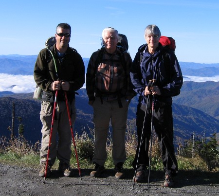
Three hikers prepared for adventure
Getting to Tennessee
My first challenge this year was trying to get to Tennessee for the annual Father-Son Backpacking Trip. My flight on Continental Airlines was to depart Grand Rapids bright and early, so I set my alarm for 0300. Kathy had left the day before to take her mother on a driving tour through southern Indiana and Kentucky, so our neighbor, Susan, generously agreed to get up early and take me to the airport. As boarding time approached then passed, we got our first hint there might be a problem. Finally, the airline representative notified us the plane had no power. Not only that, but that the parts to fix the problem would be arriving on another flight and a crew to repair the problem on yet another flight. Bottom line: my flight wasn't going anywhere for a while. I ultimately got rebooked on a United flight through Chicago. The Continental representative handed me a coupon for six dollars off a breakfast at the airport, but, sorry, there was no time to stop and eat. Back to the ticket counter I went to make hasty arrangements, then off to the United terminal. The flights went well, but my luggage failed to follow me. A quick check in Knoxville confirmed it was happily in route from Denver to Sacramento! They would try to have it delivered to the house the following morning.
Well, morning came and went. Checks with United's automated baggage tracking system online and by phone only confirmed that my luggage was "in route". After much difficulty, I finally discovered how to reach a human at United, who claimed the bag had arrived in Knoxville that morning. So, back to the airport we went. The man and woman at the counter recognized me from the previous day. They were happily standing and chatting away while my bag sat directly behind them. Apparently they had better things to do than please their customers. At least I had my gear.
Route
One of the trail options Craig had suggested for this year was the first section of the Mountains-to-Sea Trail (MST) in North Carolina. The first section begins at Clingman's Dome and ends at the Ocanaluftee Visitor's Center, 25.7 miles entirely within the Great Smoky Mountain National Park. The trail profile on the MST website showed the first day would be all downhill to our campsite #53, the Poke Patch Campsite. The second day was a climb to site #52, the Newton Bald Campsite, then the third day would be all downhill again. After claiming my luggage and waiting for Craig to arrive, we pre-placed the van over at the Visitor Center. There we were treated to a viewing of the local Elk herd grazing in a field.
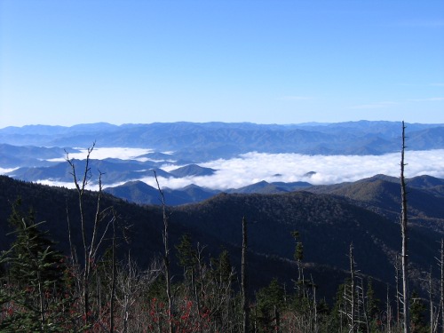
Clouds filling the valleys below Clingman's Dome
The story
Tennessee had received a lot of rain this year, so water wasn't going to be an issue. They had also experienced a cold snap the past several days. Fortunately, the forecast called for highs in the upper 60's with lows in the 40's for our trip, with sun the first couple days and a chance of rain the last day. When Mom dropped us off at Clingman's Dome, there was snow on the ground, but we had sunny skies. In fact, we were looking down at the clouds filling the North Carolina valleys below. We climbed the 0.5 mile walkway to the start of the trail, and by the time we had navigated the first slippery mile of trail, we were stripping to shorts and tee shirts, an odd incongruity with the snow patches around us.
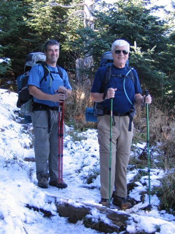
Snow on the ground but warm temperatures
The long downhill stretch the first day turned out not to be as steep as the impression I had viewing the profile, and my knees remained in good shape. It was, in fact, a very nice walk, although a bit muddy in places from all the recent rain. I kicked up a Grouse early on the hike, but no significant wildlife was spotted. We enjoyed several views of the color on the adjacent ridges as we followed first the Appalachian Trail, then the Sugarland Mountain Trail and, finally, the Fork Ridge Trail to the Deep Creek Trail at our first campsite. Coming down the Fork Ridge Trail, we met a couple of women (Danny and "Smoky Scout") taking a break. They warned us of a deep water crossing just prior to our campsite. They would pass us later as we were taking our own break, then we caught up with them again at the water crossing. It turns out they are quite the serious hikers, having completed all the trails in the Smoky Mountains and now tackling the MST as a series of section hikes. The water crossing turned out to be only about knee deep. I had missed mention of the crossing in my reading on the route, and hadn't packed sandals. So, I pulled off my socks and removed the inserts from my shoes and waded across in shoes. Fortunately, the campsite was right there, so I would have ample opportunity to dry things by the fire that night.
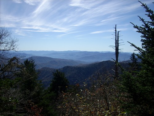
A view from the trail
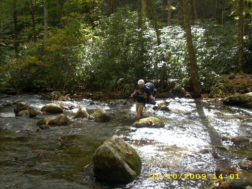
Dad makes his way across the cold water
The first campsite was a flat open area next to a nice creek, surrounded by steep hills choked with underbrush. Our biggest challenge was finding trees from which to hang our hammocks. We settled on a small cluster that isn't likely to be there long; some were mere remnants of trees, and one tree stood perched high off the ground by its root system (it had clearly grown off a now-decayed and gone fallen nurse tree). Dad and Craig scavenged for wood, while I processed their findings into piles of firewood. Although a bit wet, Craig urged a nice fire out of the results, and we enjoyed a nice dinner, cocktails and conversation. It got cold that night, somewhere in the mid-30's, and I awoke once to add a layer of clothes. We hadn't bothered to string the tarps over our hammocks, and it was pretty with the star-filled sky (although the tarp would have added a little insulation).
After breakfast the following morning, we prepared for the day's climb. There were a couple more water crossings, but they were relatively shallow, and I did them barefoot. The trail followed rushing water for four miles and was beautiful. In high water, some of it might have been a bit treacherous, but it was mostly rock-hopping for us. Martin's Ridge Trail led to Sunkota Ridge Trail to Thomas Divide Trail to Newton Bald Trail. Fortunately, the MTS is well marked, so we weren't forced to pull out the map at each junction to decide on the next trail. The climb was not as steep as we had feared, but by the end of the day, we were ready for the next campsite to appear. We were glad the high temperature was a few degrees cooler than the previous day had been, and there was a nice breeze.

A pretty stretch of trail
Newton Bald Campsite sits right along the trail, but offers plenty of trees and a view off both sides of the ridge. The small spring just down a short but steep side trail offered plenty of water, a good thing considering we found a group of fourteen college students setting up camp on an adjacent knoll. They were a nice group of people, mostly inexperienced, but led by a capable leader. After driving twelve hours from Michigan, they had immediately set about hiking uphill to the campsite. Needless to say, we didn't hear much from them.
The wood here was drier and more plentiful, and Dad had a hot fire going in no time. It turned out to be an earlier night for us, too, after our climb. Although breezier on the ridge, it was also a warmer night than last, and sleeping was good. The rain moved in overnight, but had slowed to a fine mist by breakfast time. We warmed by the fire, then packed under our tarps for the final leg of our trip.
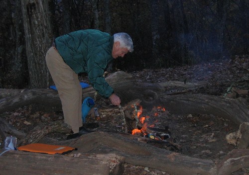
Dad plays Fire Master
The trip down Mingus Creek Trail was nice with a few ankle-twisting rocky sections toward the end. The drizzle came and went intermittently, mostly starting up again shortly after each time I decided to put away my rain gear. Dad scared up a Grouse, but that was the extent of our wildlife viewing. We toured Mingus Mill at the end of the trail, then walked back to the van waiting at the visitor's center. A young bull Elk was entertaining tourists there, and we stopped to take some pictures.
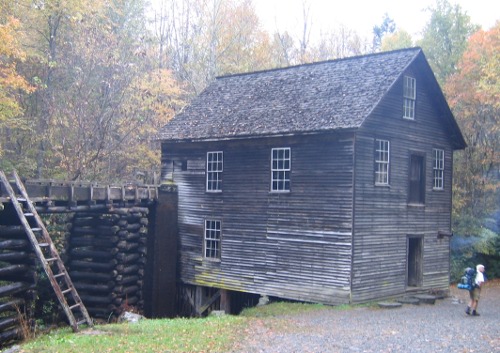
Mingus Mill
Après hiking
It was a long ride home. Tourists choked the roads and made for slow driving. Then, just as we cleared the top of Newfound Gap, the rangers had closed the road down the Tennessee side (either due to an accident or a robbery we later heard about in Townsend, TN). We were forced to turn around and travel back to Cherokee, then take I-40 around to the Tennessee side. We stopped in Townsend to pick up pizza for our traditional pizza and beer post-hike party, then headed home. Mom had headed off to North Carolina for a Fiber Fair, and Kathy hadn't come down with me, so we had no audience to entertain. Instead, we downloaded our pictures and retold the stories to ourselves, then did our laundry.
Dad whipped up a fine breakfast the next morning, then Craig departed for home. Dad and I did some chores around the house, then watched the Vols get beat and the Fighting Irish barely pull their game off.
Craig's story is available on his blog.